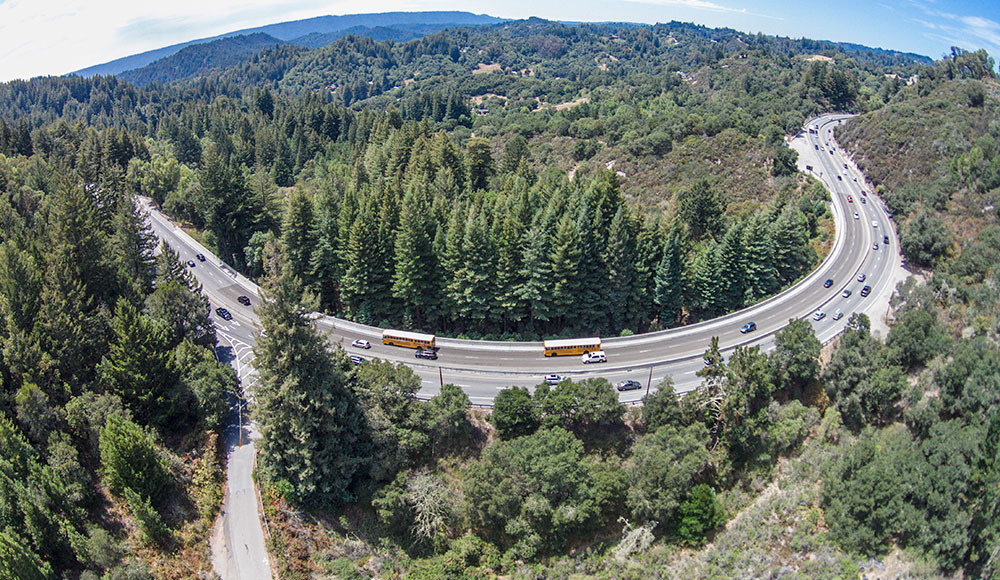
The Santa Cruz Boardwalk Giant Dipper has drawn over 60 million thrill-seekers to scream while careening around the roller coaster’s hairpin turns. But more than 65,000 motorists a day know that roller coaster ride pales compared to the high-speed, white-knuckle turns it takes to get to and from Santa Cruz by driving over Highway 17.
On one of the most dangerous highways in the state, the stakes are high for people and even higher for animals. In 2012, Caltrans installed median barriers at a particularly treacherous piece of the road known as Laurel Curve that increased safety for people but made it even more difficult for deer, bobcats, foxes and mountain lions to cross.
Extensive roadkill data showed Laurel Curve to be the deadliest section Highway 17 for wildlife. In three years there were 12 recorded deer-vehicle collisions and four recorded mountain lion collisions, according to the Land Trust of Santa Cruz County.
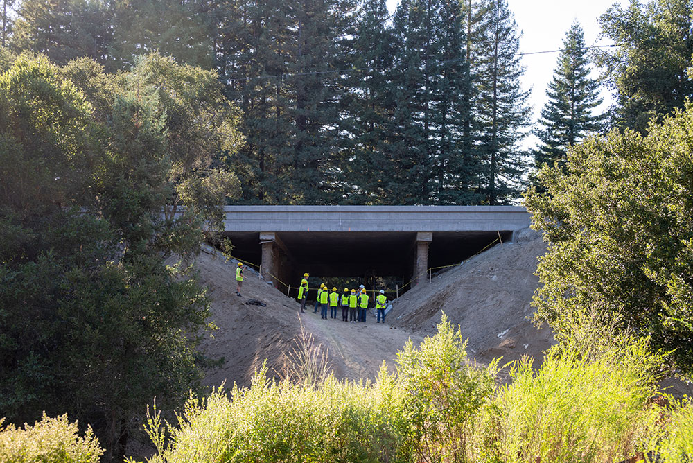
In December 2022, Caltrans and the Land Trust built a wildlife tunnel under Highway 17 at Laurel Curve. It’s been more than a year since the Highway 17 wildlife crossing was completed, and on Nov. 9 at the Rio Theatre, Land Trust of Santa Cruz County representatives will share the results.
This event will feature ecologists and researchers Tanya Diamond and Ahíga Snyder from Pathways for Wildlife, with an introduction by Chris Wilmers, Ph.D., from the Santa Cruz Puma Project. The event is sold out, but a recording of the presentation, complete with footage of wildlife using the crossing, will be available at landtrustsantacruz.org in December.
Everything That Breathes Needs Three Things
Ahíga Snyder of Pathways for Wildlife says, “It’s a law of nature: if you don’t move, you don’t survive. It’s true for people and it’s true for animals. They are driven to mate, to find food and water, and to find territory.”
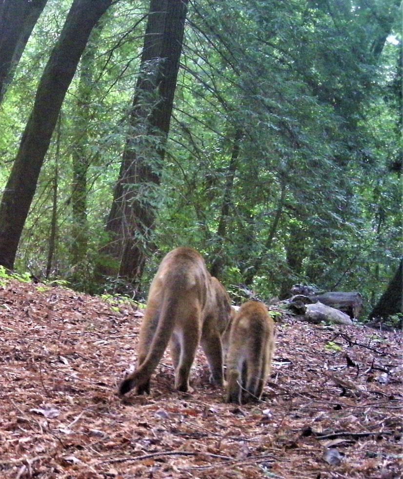
Land Trust of Santa Cruz County Conservation Director Bryan Largay agrees and adds, “The canary in the coal mine is the mountain lion; it’s a big animal so there aren’t very many of them. There are only 50 or 60 adult breeding mountain lions in the Santa Cruz Mountains and if they can’t cross Highway 17 to mate, inbreeding can lead to genetic defects.”
Explaining what those might be, Largay says, “Tails can get disjointed and kinked, and they’re more vulnerable to disease and not as effective at surviving. The kinked tail is a classic sign of inbreeding and lack of fitness.”
Largay says that an adult male lion has a territory of about 8,000 acres. “The forest of Nisene Marks would be the territory for one adult male, and the females have a territory of about 4,000 acres, so an area that size might support two female mountain lions and one male.
“One way lions die is being killed by older, bigger lions.” Largay explains. “When a young mountain lion starts to grow up, it must find its own territory because if it stays near where other adult mountain lions are, it’s likely to be attacked and killed.”
Mountain lions, deer, bobcats and foxes must be able to cross Highway 17 to survive, and have all been caught on camera trying to cross. Data from the Land Trust made it clear: a crossing was critical for providing a path for wildlife to safely travel between habitats—and for ensuring driver safety by keeping wildlife away from the highway.
The tunnel at Laurel Curve provides wildlife with a safe way to get to a mating ground across the highway. Research by the Santa Cruz Puma Project’s Wilmers shows extensive use of the area by mountain lions. Wilmers called Laurel Curve “the best opportunity for maintaining puma connectivity across Highway 17 in Santa Cruz County.”
The $12 million allocated for this wildlife crossing tunnel is a drop in the bucket compared to the total economic cost of wildlife-vehicle collisions in California. Over the past five years, vehicle collisions with wildlife have cost Californians an estimated $1 billion (newsweek.com/wildlife and pewtrusts.org ).
Land Trust of Santa Cruz Marketing and Communications Director Vicki Lowell tells me that on Nov. 9, UCSC puma tracker Wilmers will open the event and Land Trust Executive Director Sarah Newkirk will also make opening remarks. Two scientists from Pathways for Wildlife will show videos from the Laurel Curve Highway Tunnel and explain their findings.
Expert ecologists and researchers Tanya Diamond and Ahíga Snyder will share their year-one findings and footage of wildlife using the Highway 17 crossing. They will discuss the work of the Puma Project at the University of California Santa Cruz and Pathways for Wildlife that provided the necessary science.
The Puma Project is a partnership between UC Santa Cruz and the California Department of Fish and Wildlife. Lowell says, “The Puma Project put collars on mountain lions that collect movement and location data from each animal.”
That research offers insight into how these animals are affected by the humans that increasingly surround them. According to Wilmer, “We played recorded sounds of people talking and sounds of frogs. When mountain lions heard the frogs, they would look up for a second and then continue eating. When they heard a human voice, they would run away. People influence everything these animals do.”

Why Laurel Curve?
Largay, the Land Trust’s conservation director for 12 years, explains that the leap toward Laurel Curve was motivated by the Puma Project’s data from collared mountain lions. “Animals like to follow topography in the sense of approaching saddles. They’re not going to walk over the top of a mountain if they can walk over the saddle between two mountaintops, where it’s lower. It turns out that both deer and mountain lions really like forest cover.”
Laurel Curve consists of relatively large parcels of forest on either side of the highway, Largay says, and is the least developed area between the city of Scotts Valley and the summit of Highway 17. “The Land Trust protects 190 acres on the west side and 280 acres on the east side of Laurel Curve, for a total of 470 acres—sufficient acreage to create and sustain the wildlife corridor across Laurel Curve.”
Santa Cruz County approved Measure D in 2016, which the Santa Cruz County Regional Transportation Commission put on the ballot to fund the underpass. Local construction firm Graniterock built the crossing.
Largay says the primary toolkit for Land Trust Santa Cruz is to purchase land and acquire rights to an easement. “A conservation easement is typically a deed restriction where we purchase the rights to develop the property. At Laurel Curve, all three of the properties adjacent to that project are now owned by others with conservation easements on them.”
Animals love having good vegetation cover, and they also tend to follow trails, Largay says. “One of the cool things the Puma Project did is with all of their radio collars on mountain lions, they were able to track the motion of dozens of animals around the Santa Cruz Mountains over 15 years and then develop powerful statistical models of where they like to go.”
The Santa Cruz Puma Project has provided a map with the home range center of each collared animal tracked in 2017. Go to santacruzpumas.org/puma-tracker and select a mountain lion from the list on the right. Use the time slider above the map to animate the track to see where each puma ranged. The Puma Project says it’s just a rough guide, but it is fascinating to watch where each of these cats travel and migrate from one of our communities to another.
Pumas Don’t Want to Eat Your Pets
People who worry about their dogs or cats being eaten by a 140-pound mountain lion should know that this tunnel makes it less likely that mountain lions will kill their pets. Largay asserts, “It gives pumas a path to good quality habitat where they can eat deer. Chris Wilmers’ data sampled a lot of mountain lion scat, and 98 percent of the DNA in mountain lion scat in our area is deer. They’d much rather eat a deer.”
Director Largay contends that the Santa Cruz Mountains are like an island, and islands are where extinctions happen. “We want to connect the Santa Cruz Mountains to the mountain ranges next door, so that all sorts of different wildlife can move back and forth across the landscape,” he says.
He describes mountain lions as the canary in the coal mine. Because their numbers are so low, they will have genetic problems first. Other species are probably having genetic and habitat problems as well, such as badgers or western pond turtles. Those problems will just show up later.
“The key for all these species is for migration to be easier, so new animals can come into the Santa Cruz Mountains and bring genetic diversity,“ Largay says.
Another project in the works in neighboring San Benito and Monterey counties will open up more avenues for wildlife to leave their mountain island.
“In ecosystems and in genetics, with diversity comes stability and vigor. Caltrans and the Land Trust of Santa Cruz will create a crossing at Highway 101 for wildlife to safely journey between the Santa Cruz Mountains and the Gabilan Range, with a new crossing at Rocks Ranch,” Largay says.

Driving Smarter, Slower
Over one million collisions occur yearly between cars and large wild animals in the U.S., causing approximately 200 human deaths, 26,000 injuries and at least $8 billion in property damage, according to a 2008 Department of Transportation report to Congress.
The Humane Society and the Animal Protection Institute estimate that 1 million animals die on the road every day in the U.S., about twice the number of animals killed by hunters. Largay says, “We’ve had over 800 deer crossings through the wildlife tunnel, and those are deer that aren’t on the highway.”
Slower is safer on Highway 17. I saw a bumper sticker on a car going exactly the speed limit that said, “Yes, I see you behind me. And no, I won’t speed up.”
The Land Trust of Santa Cruz offers these tips on how you can reduce the risk of accidents involving game:
- Many animals are on the move at night or at dusk. Be especially careful then.
- In addition to deer traffic, poor visibility in autumn increases the risk of accidents. Adjust your speed to the visibility conditions.
- Drivers should take the danger sign “Wildlife Crossing” seriously, reduce speed and keep an eye on the edge of the road.
- As soon as an animal comes into view, drivers should switch to dipped headlights so that the animals are not blinded.
- Many animals travel in groups: if one animal appears, expect more.
- Avoid radical evasive maneuvers with your car; crashes happen so fast.
Be safe out there, and in December check out the video footage of wildlife using the new Laurel Curve Highway 17 crossing at landtrustsantacruz.org.


