

“We think that we are entering a phase where there will be more damaging earthquakes in the future.” —Stanford geophysicist Kurt Hickman
Geologists may cringe at my anthropomorphism; I’m trying to get a feel for what shaped these mountains we call home. The 1906 San Francisco earthquake’s rupture was 296 miles along the San Andreas Fault; it moved like an uncomfortable Mother Earth had shrugged her shoulders 32 feet to the side.
The ephemeral 1989 quake was much shorter; the tear was 26 miles but much deeper, 11 miles deep. This gave the two tectonic plates sliding past each other a vertical component, as if for 20 seconds Mother Earth was lifting her butt to realign her sitting bones. As we are experiencing from climate change, when Mom is uncomfortable, all hell breaks loose.
Touring the Rupture
An earthquake epicenter is the part of the earth’s surface directly above the focus of the rupture. So, why hike to the Loma Prieta earthquake epicenter? Maybe we just want to be able to say, “Yeah, I peed there.” Or maybe to get a sense of how our mountains move underneath us.
When the congenial geologist Dwight Harbaugh said he would join our group on a walking and seismic-talking tour up the Loma Prieta Trail, word of the hike spread through my hiking group as if by underground rumbling. The geologist can hold a sandstone rock and mesmerize you for 15 minutes with the story of how that rock got there. His passion to ponder the mysteries of the Santa Cruz Mountains is infectious and we’re all excited to hike with him.
We plan to rendezvous at the Aptos New Leaf Market at 9am on a Saturday. I over-worry the traffic on Highway 1 and arrive a half hour early. I walk through New Leaf to marvel with sticker-shock at all the boutique, organic food. I choose a sandwich and listen to the young cashier tell me his New Year’s resolutions. They sound like a to-do list for the first week of January. I tell the cashier that I heard of a woman who opened a fitness club called Resolutions.
“It has exercise equipment for the first week and for the rest of the year she turns it into a bar.”
The cashier stares at me and finally says, “You’re making a point. There is no bar called Resolutions.”
“No.”
I make a resolution to try not to be such a curmudgeon. I’d better go take a hike.
Mapping the Faults
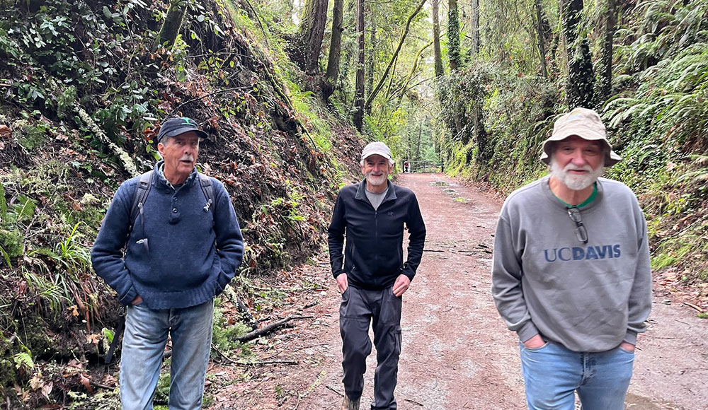
I walk outside at 9 and of course geologist Dwight Harbaugh is precisely on time; time is his game, albeit a very long game. Ben Rice and Sleepy John Sandidge show up uncharacteristically late due to John’s early morning bout with an exploding jar of pasta sauce. Boy, is his face red. His shoes as well.
Santa Cruz literary lion Wallace Baine arrives with his author wife, Tina, on his arm, and Santa Cruz Comic News publisher Thom Zajac shows up with his latest graphic creation, a map of the Santa Cruz Mountains, colored by elevation. Thom unrolls his panel on the New Leaf sidewalk and we ooo and aah as Dwight points to where the fault lines run that combined to create the earthquake of 1989.
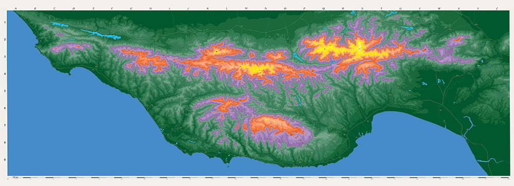
Thom Zajac’s graphic of the mountains shows Loma Prieta Peak, the highest point in the Santa Cruz Mountains, towering over rugged country, and we consider that the trail we’re going to be climbing or descending is 6.0 miles out and back. Sleepy John is concerned about being able to make the full hike, and my left knee is speaking to me about the distance as well.
We are through hikers, meaning after six miles we’re through. There are those of you who leisurely do 20 miles in six hours and throw in some rock climbing to crack a sweat, but our hikes are easy-to-moderate day hikes. We do like to throw the ball farther than we can walk to catch it, and the farther Sleepy John and I walk in the damp, overcast morning, the warmer our stiff joints get. One joint in particular helps us forget about the stiff ones.
The trail starts with a wide, well-graded road that uses the old railroad grade that the Southern Pacific Railroad built in the 1880s to harvest the biggest trees on earth. Dwight explains that the slope is gentle because the old trains could not handle more than a 3% grade. To build these railroads, the Irish would drink whiskey; the Chinese would smoke opium. We speculate on what we would medicate with if we were building it today.
“Coffee and weed! The poor man’s cocaine!”
“Cocaine! The broke man’s coffee and weed!”
My construction worker buddies tell me if John Henry were alive today and needed medicine to whop that steel on down, it would probably be an opioid.
We stop in a section of road that is a deep cut into the mountain and can see layers of sediment and marine fossils. Dwight explains, “This part of the county is underlain by the Purisima Formation, consisting of 3-million-year-old shallow marine deposits formed on the continental shelf, of clam shell fossils and fine sediment from the erosion of adjacent land. Over time—lots of it—the Purisima was uplifted and is now exposed. In 1989 it took the Loma Prieta earthquake 20 seconds to lift the land 20 inches.”
Whose Fault Is This?
The Loma Prieta earthquake of 1989, with a magnitude of 6.9, occurred due to forces along the San Andreas Fault. This fault is a transform boundary where the Pacific Plate and the North American Plate slide past each other horizontally. On Oct. 17, 1989, at 5:04pm, the Loma Prieta earthquake shook the ground from Monterey Bay to the north of San Francisco. It knocked down part of the Bay Bridge, collapsed a section of freeway in Oakland, destroyed much of Santa Cruz’s Pacific Garden Mall and stopped the 1989 World Series. It caused 62 deaths, 3,757 injuries and more than $6 billion in damages.
Historically, the San Andreas is the most studied fault on earth. That was before people started studying whose fault it was that place kicker Jake Moody’s extra point in the 2024 Super Bowl was blocked, causing the 49ers to lose to the Kansas City Chiefs.
When we look at what’s to blame for the Loma Prieta earthquake, it’s the San Andreas’ fault, where the Pacific Plate and the North American Plate meet. Dwight explains that the earthquake was caused by the two tectonic plates slipping and sliding in opposite directions, with a strong vertical component as well.
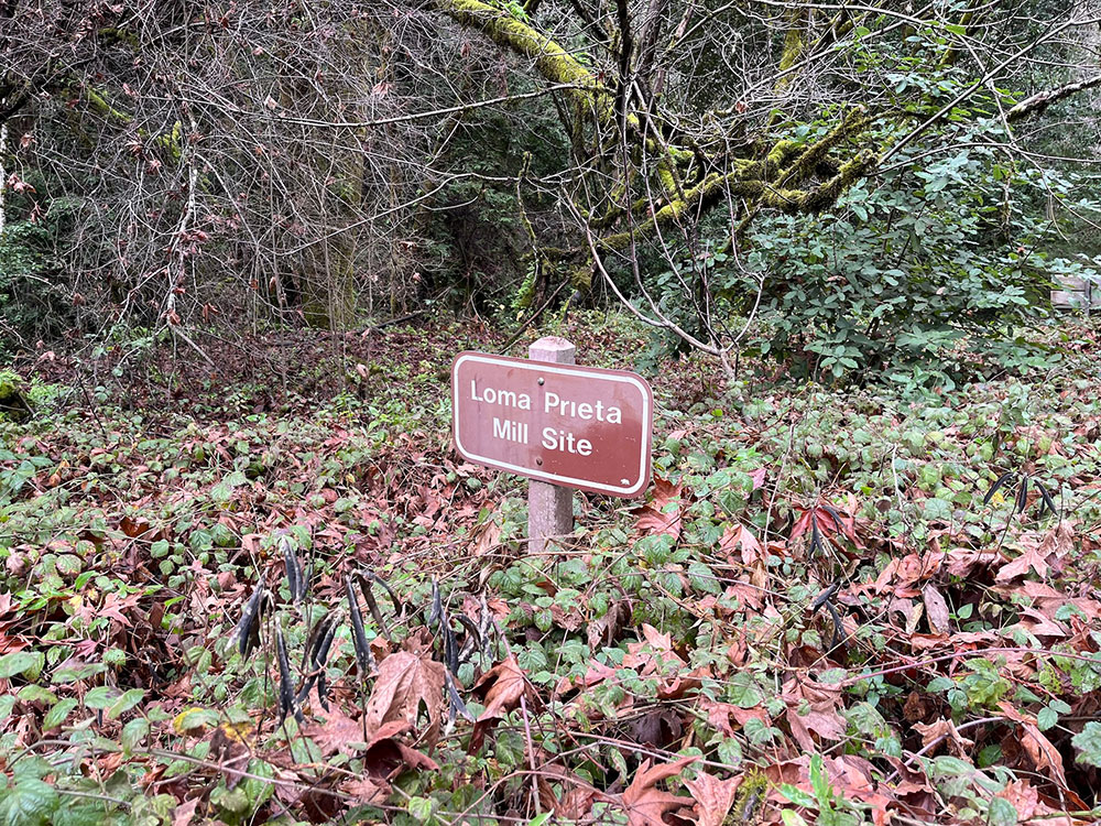
Dwight tells us that locally quarried granite used as road gravel is basically the tail of the Sierras that got cut off by the San Andreas Fault. When we finished the short hike to the old town mill site of Loma Prieta, we discover that what remains is a sign that says this is the old town mill site of Loma Prieta.
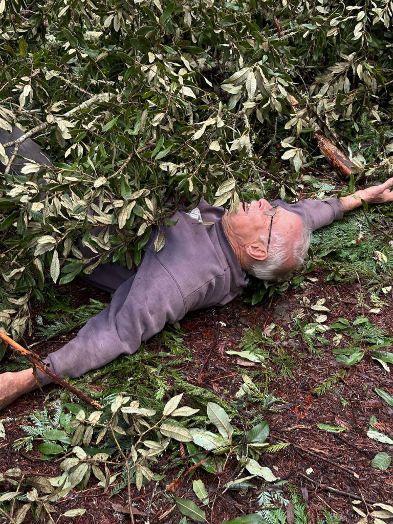
Ben took a photo of Sleepy John that shows him apparently crushed underneath a fallen tree. No such luck, but John did lose his voice later that day. Imagining the radio legend without a voice feels like standing on the edge of an abyss that echoes distant calls for song requests.
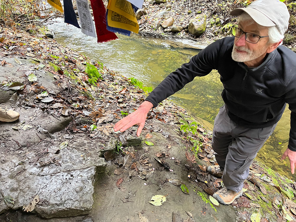
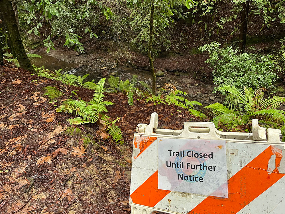
We almost make it to the epicenter, which is slightly east of the Zayante Fault, but the final path to it is closed for now. Dwight tells us we wouldn’t see much anyway because the quake did not cause a rupture at the epicenter surface.
On the way back down, I see Wallace and Tina walking far ahead of us, together in ambulatory solitude. They are talking, each leaning a bit toward the other as they speak. I am reminded of a Thomas Benhard quote: “There is nothing more revealing than to see a thinking person walking, just as there is nothing more revealing than to see a walking person thinking.”
How to Get There
Take the Aptos Creek Trail in the Forest of Nisene Marks State Park. The hike is about 6 miles out and back. It is mostly a gently graded road, the sign marking the epicenter is about 0.6 miles east of the fire road intersection.
In the winter, the upper parking lot is closed, so you can park at the lower parking lot on Aptos Creek Road and hike the first mile to the trailhead. Dogs are allowed on the trail on leash.
Please check the parks.ca.gov website. As I write this, I notice they currently have the Aptos Creek Trail closed due to storm damage and erosion.
For more info about Thom Zajac’s Santa Cruz Mountains Art: ba*****@*****on.com


Great article. But, geesh I was waiting for the announcement of when yall were going again. I would love a guided hike but those who know things like geology and history. Consider offering a public hike?
Hiked almost to the sign..but saw the old Mill site and probably would have gotten there if I had hiked just .1 mile more