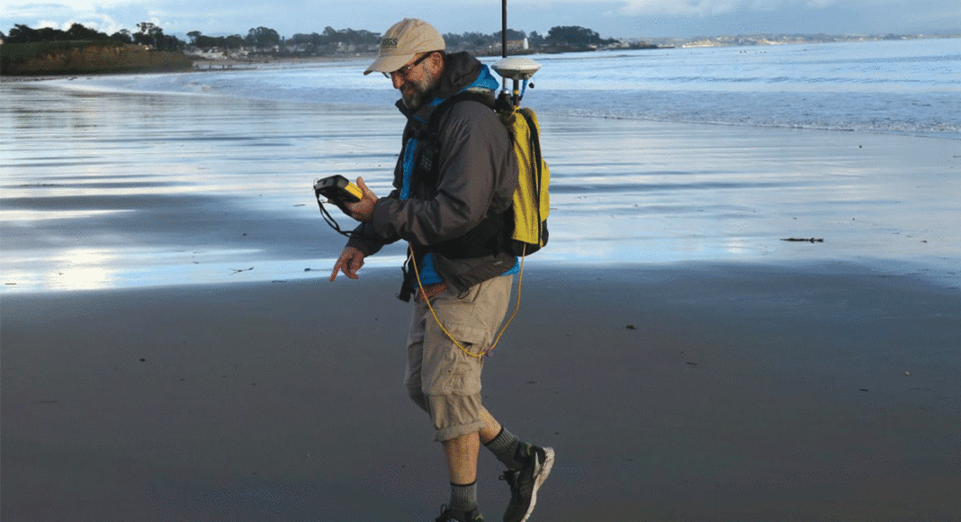
The series of storms that ripped through Santa Cruz County since December created landslides, triggered flooding, downed trees and engorged rivers. While city, county and state agencies sweep up the damage, a team of United States Geological Survey (USGS) scientists are measuring its changes—with sonar, stream gauges, GPS, lasers and water sampling—to predict how future storms will shape our coast.
Longtime locals remember the landmark storms of 2006, 1998, 1997, 1995, 1982 and perhaps even 1955, when the county was declared a disaster area. So far, this winter’s storms have not approached that level of emergency.
What’s remarkable about this season isn’t the intensity of its rains, but rather their frequency. Since Dec. 15, the San Lorenzo River has reached the two-year flood mark (a level you’d expect once every two years) an astonishing six times, says Amy East, a USGS geologist.
In 2014 and 2015, the river didn’t even come close to that mark once, she says.
“It’s a lot more exciting than it has been in the past two years,” she says.
In each of the recent storms, her team sampled the river around the clock to see what it’s sending from the mountains into the ocean—how much sand, sediment and pollutants. The results have not yet been tallied.
What’s clear though, is that the San Lorenzo River has been dumping tons of sand into the ocean, much more than in recent years. Preliminary estimates show the river has emptied the equivalent of 10,000 dumptrucks full of sand from its mouth, spreading it onto Main Beach and Seabright Beach, says Patrick Barnard, a USGS coastal geologist.
That’s a good thing, he says, since the sand replenishes the beaches and guards against coastal erosion. Last winter was an El Niño year, with the largest waves ever recorded locally and below-average rainfall—a recipe for sand-starved beaches, he says. Large swells rip sand from beaches onto offshore sandbars, and storms replenish the beaches, pushing sand downriver, onto the beaches.
Building Beaches
Soquel Creek has also spewed roughly 10,000 dump trucks’ worth of sand this winter, except it’s created a more dramatic effect there, since the mid-county watershed is smaller and steeper, and shaped like a chute.
On Jan. 10, 11 and 12, when the tides reached their lowest levels of the year, Capitola Beach at Soquel Creek’s mouth was as wide and dry as anyone has ever seen, says Barnard.
“It extended 100 meters past the jetty,” he says. “The beach has been flattened though, and at high tide, there’s almost no beach. It’s a big, wide, flat terrace with lots of sediment that’s built out in this delta.”
The concern is when high tides coincide with peak swells and storm surges, the village depends on its seawall to keep the ocean out, he says.
High tides coupled with storms and big waves did just that over the weekend, Barnard says, and brought flooding to parts of mid-county, including the Capitola Esplanade. He called the storm a “severe erosion event for many beaches.”
Effects on Residents
The list of damages from this winter’s storm is getting longer. Landslides have intermittently closed some of the county’s main roads—Highways 17, 9, 152 and 35. The Jan. 9 storm washed away chunks of Bear Creek Road—a crucial artery for Silicon Valley commuters who live in the Santa Cruz Mountains—and it has been closed outside of Boulder Creek since. Downed trees also felled power lines in South County.
In Santa Cruz Harbor, six boats have been moved because of sediment buildup at the north end of the harbor, where Arana Gulch is spitting out sand and debris, grounding boats.
The city of Santa Cruz declared a local emergency Jan. 11 after a major water pipeline burst, likely due to the ground shifting from the storm’s saturation. Residents were asked to cut their water use by 30 percent, since the leak gushed around 1,500 gallons per minute for several hours before it was closed. The fix has cost $100,000 so far, said Eileen Cross, community relations specialist for the Santa Cruz Water Department.
A Sign of What’s to Come
On Jan. 12 and 13, Barnard and his team surveyed the beaches and beds of Soquel Creek and the San Lorenzo River with laser scanners, GPS and sonar, to map the changes from the storms.
The better we can understand how storms change the coast, the better we can predict how the coast will evolve in the coming decades, Barnard says.
“Sea level rise is happening. It is accelerating and it’s going to continue,” says Barnard. “It’s not a belief. It’s a scientific observation based on work from all over the world and thousands of scientists—literally trillions of observations from the land, the atmosphere and the ocean.”
Scientists predict that winters will get stormier, with larger waves, more floods and extreme erosion. With sea level rise, more sand needs to flow from the rivers to replenish the beaches. But that’s the opposite of the trend, with more rivers being dammed and beaches starved of sand. Our coastlines are vulnerable to damage, says Barnard.
At noon on Friday, Jan. 20, the instant President Donald Trump took office, any mention of climate change was erased from the White House website except under Trump’s “America First Energy Plan,” which starts by undoing Barack Obama’s “unnecessary” Climate Action Plan.
That kind of partisan censorship, Barnard says, has no place in scientific discussions, and he believes incidents like this should force experts to be more vocal and clear about the evidence at hand.
“[Climate change] is not a debate,” he says, “and it’s definitely time that scientists become much more outspoken and less passive about what we know.”


